
The Royal Society of the British Empire and the government wished to establish definitively whether or not Terra Australis, a large fertile land south of Australia. Their goal was not simply to find new lands, people or plants. They were primarily interested in matters related to trade. The logic was simple: the more land Britain controlled – and, indeed, land from which it could extract valuable raw materials or which would be safe markets for products manufactured in Britain – the more it would grow commercially and become richer as a country.
With this logic, his second trip was decided James Cookwhich aimed to circumnavigate the globe. Cook had already made a voyage, during which he had proved that New Zealand was not connected in the South by any larger land, and he had charted almost the whole of the east coast of Australia. But this was not sufficient proof for the members of the Royal Society, as Terra Australis was believed to lie further south. The ship “Resolution”, which had been selected for this particular voyage, set sail for her Antarctic in July 1772. This second voyage would be completed in 1775.
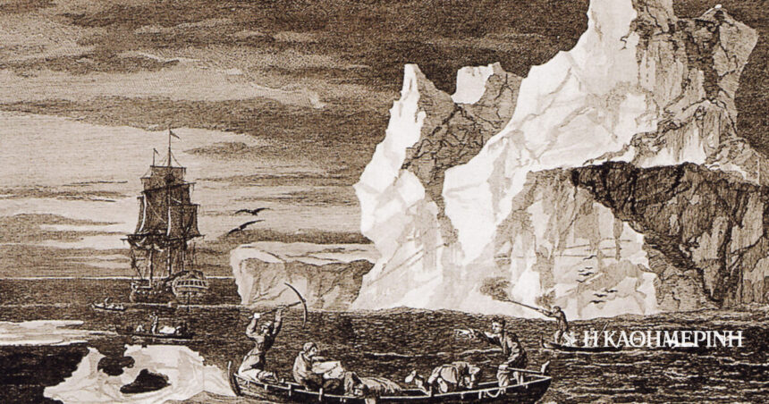
On January 17, 1773, the Resolution would be the first ship to venture south of the Antarctic Circle; something she did twice more during that voyage. Excerpts from the diaries of those who were on board are characteristic. According to Cook, “from the top of the mast I could see nothing to the southward but ice, the whole extent from East to West […] it consisted of different types of ice, such as high hills or islands, smaller pieces clustered close together […] I didn’t think it was […] in no way wise […] to persevere that I may go further to the South.’
The captain of the “Resolution” made a series of explorations in the Pacific, the result of which was the proof that the coveted temperate lands did not exist.
Charles Clerk, on the other hand, second lieutenant of the ship, reports that the “islands of ice» multiplied if one saw them from a distance, making it impossible to count them. In his diary, William Wales, again, recorded not only locations, conditions and people in the places they encountered, but also the use and testing of various instruments. Among them, the Larcum Kendall K1 – essential for attempted crossings south of the Antarctic Circle – was successfully used by him to calculate longitude. The last such passage of the “Resolution”, which was to be the longest, reaching latitude 71°10′ south and longitude 106°54′ west, took place on February 3, 1774.
During the voyage, the ship visited, among others, Easter Island, Tahiti, Society Islands, Niue, Tonga Islands, New Hebrides, New Caledonia, Norfolk Island, Palmerston Island and South Georgia. In fact, in many of them it was Cook who gave them their names. At the same time, the captain of the “Resolution” made a series of explorations in the Pacific, the result of which was the proof that these coveted temperate lands did not exist. Thanks to this second voyage of Cook, therefore, it turned out that Terra Australis was nothing but a myth.
Column editor: Myrto Katsigera, Vassilis Minakakis, Antigoni-Despina Poimenidou, Athanasios Syroplakis